Some of the maps I've made.


I like to collect and utilize geospatial data for help-out to decision makers.
I want to develop my technical skills to address the challenges in geospatial information to improve the Humanitarian and Technical fields.
Some of the maps I've made.
Some of works i had involved.
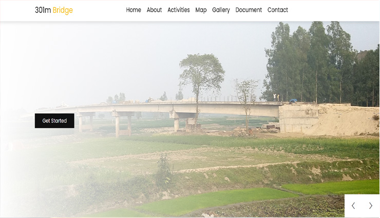
CONSTRUCTION OF 301.30M LONG PSC GIRDER BRIDGE AT NUNDAHA GHAT OVER THE RIVER KARTOA AT CH. 4+500 Km ON CHATRA GC - GILLABARI GHAT VIA NISCHINTOBATI PRIMARY SCHOOL ROAD (ROAD ID: 185764034) UPAZILA : PIRGANJ , DISTRICT : RANGPUR.

Map Mirpur is initiative project by BOIL

Village Mapping initiative for National Malaria Elimination Program by GROUP MAPPERS .

The C2M2 project in Bangladesh aims to support local authorities, leaders and policy-makers, especially those in cities and other urban settlements, in identifying the effective approaches to plan for and mitigate the effects of COVID-19

An initiative for field operation monitoring and reporting.

This is an on going Project by YouthMappes DhakaCollege Chapter an initiated to collect all dump point at Dhaka City. Which is supported by Humanitarian OpenStreetMap Team (HOT) Microgrants 2019. This map visualized dump points with its current status.

This dashboard is created for Automatically record Health facilities Field Data Collection report .

A simple map to explore the Health facilities data from OpenStreetMap Database.
Some of the Blog's I've written.
 Cox's Bazar GOB-UNICEF WASH Programme
 Accelerating Sanitation, Hygiene and Water for All (ASWA II)
 Coastal Polder Water Management and Monitoring
 State of the Map Asia. Dhaka, Bangladesh 2019.
 Dhaka Water Knowledge Days 2019.
 An initiative for low cost Data collection and map Visualization platform.